Jones Gap Loop Trail -- 10.2018

I recently was able to throw down a 11.2 mile hike. This is a much further than the other hikes I've been completing as of lately. To be honest, afterwards I was a little proud of myself. 😊
I have been to Jones Gap State Park several times in the past year since moving to South Carolina. The park is always buzzing with people to see some of the waterfalls Jones Gap State Park houses. The main of these we have previously talked about is Rainbow Falls.
However, this particular day we had set out to hike the Jones Gap Loop Trail. Typically this trail is completed by starting in Caesars Head State Park / Mountain Bridge Wilderness, going downhill for their first section, then through Jones Gap State Park for the second section, and finally rounding off the third section by going uphill back to the starting place in Caesars Head. However, I decided to travel slightly differently knowing the trails pretty well.

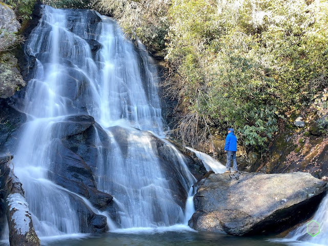
We started from Jones Gap State Park and walked along the creek for several miles, made a quick pit stop at Jones Gap Falls (photo above), then went on towards the split for the trail that came up for the loop. The beginning part of the loop was on the orange trail, which took us over several creek crossings as well as through some very dense wilderness. However, the trail was not terribly difficult and enjoyable for most anyone who can walk with ease.

The last portion of the orange trail was a bit more vertical, which is to be expected being that you are going up to a parking lot and Caesar Head State Park which sits at a higher elevation than Jones Gap State Park.
We took a break in the parking lot at Caesars Head before heading down the rest of the trail. This point was exactly halfway.
Proceeding down hill on the blue trail was an immediate aggressive drop-off an elevation. Think of going downstairs two steps at a time. Difficult, but manageable is going a bit of a slower pace.

However, once we got to the bottom of the elevation, the remainder of the walk was quite flat and enjoyable. If you go, you will pass several waterfalls and rapids to which delightedly I took several videos and photos that I will post a link below.

There was one waterfall that seemed to allude me, although it looks absolutely marvelous from a short distance. I promised myself to return and explore this particular waterfall as it looks to be about 20 feet high and very wide. The brush was too thick to get through and we were running a little bit later in the day, plus I did not want to inconvenience the rest of my party.

The remainder of the hike was fantastic and easy, although it was a bit longer than anticipated. I did not have my distance tracker app activated, nor did I have on my FitBit, but I thought we walked approximately 7 to 8 miles. According to my Apple Health app, we ended up walking 11.2 to be exact.
If you’re looking for a great long leisurely day hike, then this is a perfect one to do without being completely strenuous or in fear of possibly getting lost. The trails are very straightforward as well as plenty of sites and sounds of white water moving in either the form of rapids or waterfalls. There was also several great wildlife sightings along the way and the forms of birds and other varmints. The leaves at this point in the year were starting to change into the fall with cascade of reds, oranges and yellows making for a beautiful visual hike.

Joes Gap Trail Loop
Distance: 11.2 miles
Vertical Feet: 1,512 ft
Hike Rating: Tired but satisfied!
AllTrails Link
Video from Our Hike on Jones Gap Loop Trail:


Comments
Post a Comment